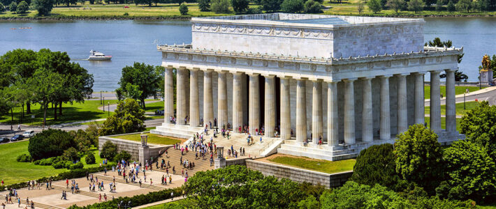
Quiz: The Lincoln Memorial: A New Birth of Freedom
Test your knowledge of the 16th President of the United States and the significance of his memorial on the National Mall in this short quiz.
Test your knowledge of the 16th President of the United States and the significance of his memorial on the National Mall in this short quiz.
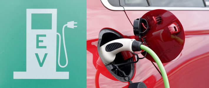
The growth in the popularity of electric vehicles (EVs) suggests yet another function for the National Mall Underground … EV Charging Center
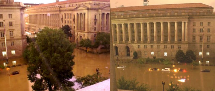
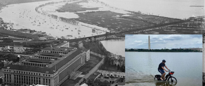
The Washington Post recently published a front-page story about flooding in Washington DC and the mixed record of DC and federal agencies in addressing the threat.
We in the National Mall Coalition mourn the death on December 25, 2023 of George Oberlander, long-time Board member and Vice Chair, and good friend.
Hurricane season spared Washington DC in 2023 but we can’t expect such good luck indefinitely.
The National Mall is the Stage for American Democracy. It’s in need of a new plan and vision for the 3rd Century. Learn more by exploring our website to better understand the legacy of the visionary 1791 L’Enfant and 1902 McMillan plans, as well as the challenges we face and innovative ways we can solve them.
On the National Mall we celebrate who we are as Americans, our nation’s founding ideals, and our civic responsibility to understand and champion the principles that sustain our democracy. Yet over the past decade, we’ve increasingly seen the visionary plans that created this iconic space trampled, the public’s use restricted, and hopes for a resilient future denied by inadequate planning. The National Mall Coalition is dedicated to reversing this trend through historical education, programming for the people, and cultivating ideas that will ensure the Mall’s vitality for future generations. We advocate for a new comprehensive plan for the National Mall, the stage for our democracy, in its 3rd century — the 3rd Century Mall.
The National Mall in Washington, DC, is the legacy of two brilliant visionary plans that have stood the test of time: the 1791 L’Enfant Plan and the 1901-1902 McMillan Commission […]
continue reading →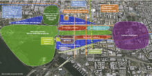
Who decides what museums or monuments can be built on the National Mall, what public activities are allowed or forbidden? Why does every new project or development plan seem to […]
continue reading →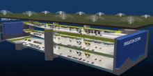
The Mall faces serious challenges and needs that require creative and comprehensive solutions: improving resilience; connecting the Mall to the surrounding community; creating new space for future museums and modern mega-events […]
continue reading →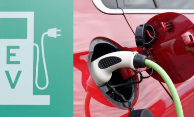
The growth in the popularity of electric vehicles (EVs) suggests yet another function for the National Mall Underground … EV Charging Center
continue reading →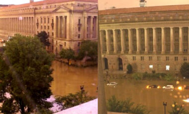
The Washington Post recently published a front-page story about flooding in Washington DC and the mixed record of DC and federal agencies in addressing the threat.
continue reading →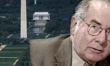
We in the National Mall Coalition mourn the death on December 25, 2023 of George Oberlander, long-time Board member and Vice Chair, and good friend.
continue reading →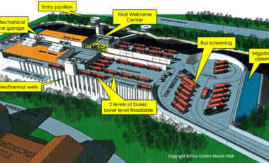
The earlier Army Corps of Engineers’ positive report showed that the Underground is an effective flooding solution. The new study shows that it can be funded with limited public expense.
continue reading →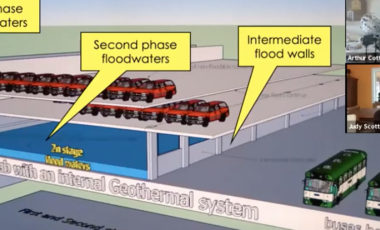
The Coalition’s June 3rd presentation turned out to be “Architecture Month’s biggest event,” according to the sponsor American Institute of Architects …
continue reading →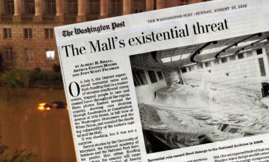
In an op-ed published in The Washington Post, the National Mall Coalition describes the existential threat of flooding on the National Mall.
continue reading →